While the concept of “deepfakes,” or AI-generated synthetic imagery, has been decried primarily in connection with involuntary depictions of people, the technology is dangerous (and interesting) in other ways as well. For instance, researchers have shown that it can be used to manipulate satellite imagery to produce real-looking — but totally fake — overhead maps of cities.
The study, led by Bo Zhao from the University of Washington, is not intended to alarm anyone but rather to show the risks and opportunities involved in applying this rather infamous technology to cartography. In fact their approach has as much in common with “style transfer” techniques — redrawing images in an impressionistic, crayon and arbitrary other fashions — than with deepfakes as they are commonly understood.
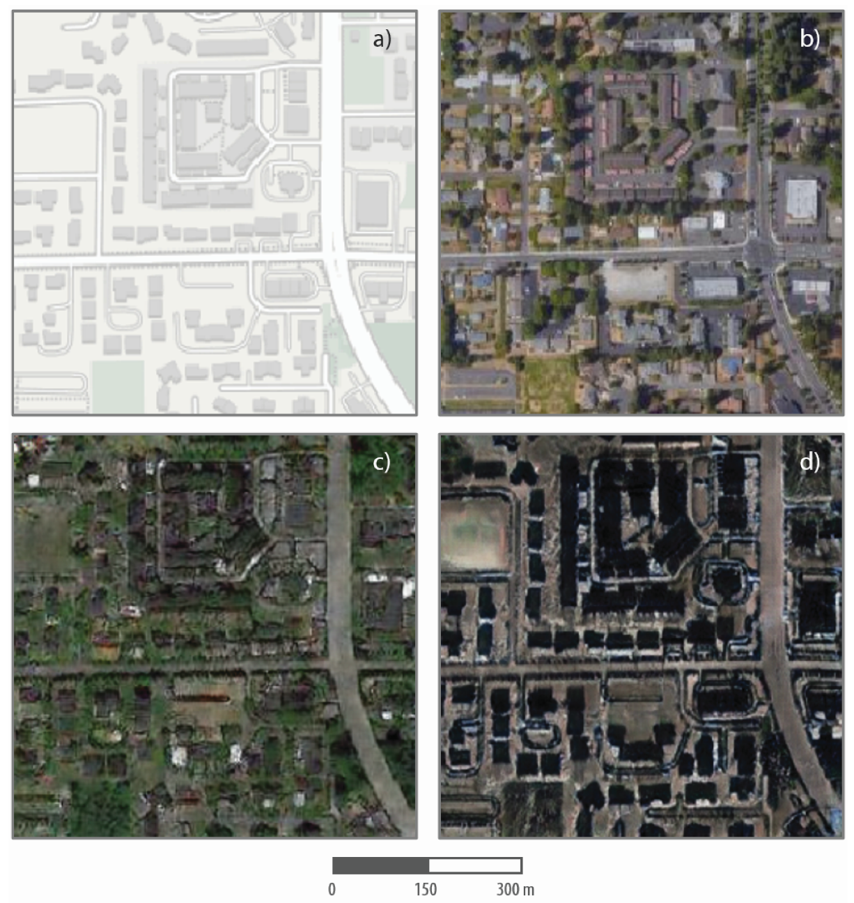
The team trained a machine learning system on satellite images of three different cities: Seattle, nearby Tacoma and Beijing. Each has its own distinctive look, just as a painter or medium does. For instance, Seattle tends to have larger overhanging greenery and narrower streets, while Beijing is more monochrome and — in the images used for the study — the taller buildings cast long, dark shadows. The system learned to associate details of a street map (like Google or Apple’s) with those of the satellite view.
The resulting machine learning agent, when given a street map, returns a realistic-looking faux satellite image of what that area would look like if it were in any of those cities. In the following image, the map corresponds to the top right satellite image of Tacoma, while the lower versions show how it might look in Seattle and Beijing.
A close inspection will show that the fake maps aren’t as sharp as the real one, and there are probably some logical inconsistencies like streets that go nowhere and the like. But at a glance the Seattle and Beijing images are perfectly plausible.
One only has to think for a few minutes to conceive of uses for fake maps like this, both legitimate and otherwise. The researchers suggest that the technique could be used to simulate imagery of places for which no satellite imagery is available — like one of these cities in the days before such things were possible, or for a planned expansion or zoning change. The system doesn’t have to imitate another place altogether — it could be trained on a more densely populated part of the same city, or one with wider streets.
It could conceivably even be used, as this rather more whimsical project was, to make realistic-looking modern maps from ancient hand-drawn ones.
Should technology like this be bent to less constructive purposes, the paper also looks at ways to detect such simulated imagery using careful examination of colors and features.
The work challenges the general assumption of the “absolute reliability of satellite images or other geospatial data,” said Zhao in a UW news article, and certainly as with other media that kind thinking has to go by the wayside as new threats appear. You can read the full paper at the journal Cartography and Geographic Information Science.